
Salem ZIP Code Directory Coverage
Two ZIP codes are identified for Salem in the official Massachusetts coding material, but they do not serve the same purpose. The regular delivery code is the useful starting point for a street address. The other code is marked for post-office-box or other post-office use. That distinction is central to a Salem postal-area search: a ZIP can confirm how mail is handled without proving that a physical parcel, household, or municipal record lies inside the same boundary.
| ZIP | Postal coverage | Post office | Record caution |
|---|---|---|---|
| 01970 | Salem’s regular street-delivery postal area, including Salem delivery addresses | Salem Post Office, 2 Margin St., Salem, MA 01970-9998 | Verify each address with USPS. A postal area is not a city-limit rule. |
| 01971 | Salem PO-box or other post-office addressing | Salem postal operation in the 01970 facility context | Do not treat it as a second street-delivery map or a physical residence location. |
The Salem Post Office listing identifies the local facility. A street result that returns 01970 needs a parcel or deed follow-up. A box address using 01971 needs an independent physical-address record before it can support a geographic claim.
Note: No official source located for this research published Salem population, voter, or neighborhood totals by ZIP code.
Check Salem ZIP Code Delivery
Use the USPS ZIP Lookup with the complete street, city, and state. Keep the standardized ZIP+4 when the service returns one, then compare the Salem address to Salem GIS or the assessor record. USPS controls delivery formatting. Salem GIS maintains municipal parcels. The two layers answer related but different questions, and neither one is a title record.
The Salem research did not document a full ZIP search form beyond the USPS address-to-ZIP route. It did document that Patriot WebPro has no visible ZIP field in its inspected legacy form. A ZIP result therefore narrows the next step, but does not create a Salem ZIP-wide assessor list.
Salem ZIP Code Voter Field
Massachusetts does use residential ZIP in its individual voter-status form, yet that form is for the voter checking their own registration status. It is not a Salem postal-area list of people at nearby addresses. The central registry’s names and addresses are generally not public under M.G.L. c. 51 §47C, and protected voters may be absent or masked.
| Secretary form field | Format | Use |
|---|---|---|
| First and last name | Required text | Must match the registered name. |
| Birth month, day, and year | Required dropdowns | Used with the name to find the individual record. |
| Residential ZIP | Required five-digit text | ZIP at the address used when registered. |
| Agreement checkbox | Required | Acknowledges the individual-use statement before search. |
The Secretary’s voter-status service also advises trying the former-address ZIP after a move and allowing time after a recent registration. Salem Elections, rather than a ZIP search, is the local contact for election process questions.
At the local level, Salem Elections is in Office 5 at City Hall. The city says an eligible Salem voter does not need to register again every year when the annual city census is answered and the person has not moved. An inactive status can still require an additional form or identification step before voting, so it should not be read as proof that someone has left a Salem address. Registration may be handled through the city office, by mail, online, at the RMV, or through the vote-by-mail application route, but none of those channels turns a ZIP into a public resident directory.
For an historical street-list question, ask the City Clerk or Records Access Officer for the specific year, ward or precinct, and record series. The State Library inventory identifies selected Salem voting-list years from 1939 through 1989. Those lists are dated civic records with their own access limits. Pair a historical list with a same-year city directory, deed, or census source before treating it as an address connection.
Find Salem Records by ZIP Code
A Salem ZIP code can organize a search, but the local records that carry the most useful evidence are keyed to an address, parcel, name, or book and page. For a Salem record search, move from delivery information to those stable identifiers. That avoids treating a postal label as a roster of residents.
- Confirm the complete address and ZIP with USPS, saving the standardized format and ZIP+4 if one is returned.
- Use the Salem GIS or MassGIS ZIP polygon to see postal context, then identify the street and parcel rather than assuming the polygon is a legal boundary.
- Search Salem Patriot WebPro by street, owner, or parcel. Its inspected form does not provide a ZIP filter.
- Use the parcel’s book and page at the Southern Essex Registry when an ownership question remains, and keep the search date with the result.
Once a ZIP has narrowed the area to a named road, the Salem street directory offers the fuller address-by-address record chain. It separates parcel owners, deeds, historical occupants, and permits instead of blending them into one list.
Salem ZIP Code and City Limits
Postal boundaries and city boundaries do not use the same system. MassGIS distributes ZIP polygon data for delivery geography, while Salem GIS maintains parcels, streets, wards, and map layers within the city. A mailing address with Salem in it may not establish that a parcel is inside Salem. The reverse problem can also appear when a record is keyed to a legal description or a plan instead of the city printed in a mailing address.
- ZIP and ZIP+4
- A five-digit ZIP names a delivery area. ZIP+4 adds a more precise delivery segment, but it is still not a parcel boundary.
- PO-box ZIP
- A ZIP used for post-office boxes or other postal use. It does not identify the box holder’s physical situs.
- Unique ZIP
- A postal code assigned to a single organization or special delivery arrangement. Research did not identify one for Salem.
- Carrier route
- A postal delivery grouping. It helps mail delivery and does not prove municipal jurisdiction, ownership, or residency.
MassGIS ZIP-code polygon material describes regular, PO-box, and unique-organization code types. Its data helps compare delivery areas, while a Salem parcel and Registry instrument resolve the record question.
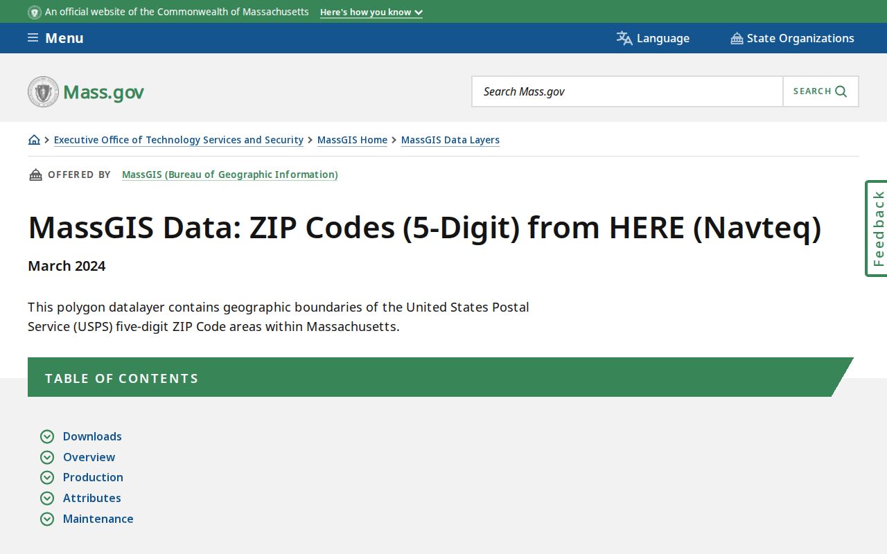
The polygon view is a useful context layer, especially when a mailing ZIP and a Salem parcel do not seem to align. Preserve the layer date with any notes drawn from it.
Salem ZIP Code Parcel Bridge
Salem’s assessor and GIS systems rely on parcel identifiers, not ZIP codes, to connect map geography to an assessment record. Patriot results can display a map-lot-style parcel ID, location or situs, owner, building information, sale date and price, plus book and page. The parcel ID is the handoff to historic property cards, street cards, maps, and the next local system. It is not the legal description itself.
For an ownership issue, take the book and page from WebPro to the Southern Essex Registry of Deeds. The Registry preserves recorded-land images from 1640 forward, while its electronic index display begins in 1951. A deed’s legal description, plan reference, parties, and recording date are stronger evidence of a transfer than a ZIP or tax-mailing address.
Note: A Salem situs and an owner’s tax-mailing address can differ, so neither field alone proves a current household.
Salem ZIP Code History Limits
Older Salem records predate modern ZIP codes. The Salem Public Library’s city-directory collection runs from 1836 to 1999 with some gaps, and its street or household sections can connect an older printed address to an occupant for a particular year. The street index and historical maps are safer than guessing a modern ZIP for an old address, especially where a directory uses an older street form or post-office designation.
The library’s digitized Salem directory collection and its street-and-neighborhood research resources offer an offline and historical fallback when a web parcel search stops. Record the directory year, source spelling, and page or section before comparing it with a census, deed, or map.
Salem ZIP Code Island Geography
Coastal geography adds a local caution. Salem’s FY26 assessor maps include island inset references, and MassGIS records that Tinker’s Island moved from Marblehead to Salem in February 2014. A historical record that appears tied to another municipality can therefore require a date check before it is treated as a mismatch. ZIP information alone will not explain that change.
The FY26 assessor maps provide parcel and easement context, but the city labels them for assessment, planning, and reference rather than survey or title use. Pair a dated map with the appropriate deed, plan, or municipal record.
Salem ZIP Code Post Office
This Salem ZIP reference begins with postal verification, not a people list. The official Salem facility information supports the local post-office step, while USPS address results determine the delivery code for a particular street address. Do not use the PO-box code as a shortcut to a physical location, and do not infer a person’s current address from an old directory, a mailing field, or a single parcel owner name.
Review the Salem Post Office location record before contacting the facility about postal services.
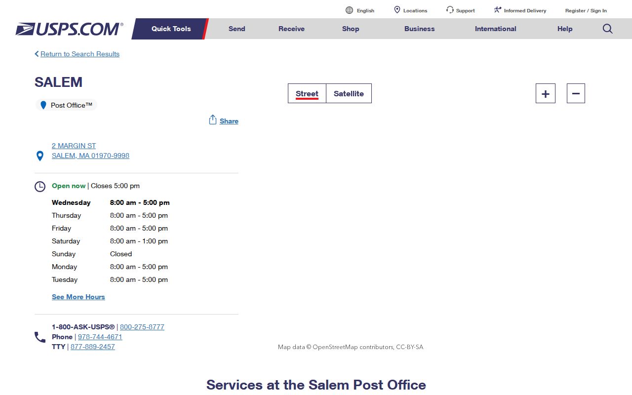
That official source anchors the mailing side of the search. Parcel, deed, and historical-directory sources remain necessary for municipal, ownership, and past-address questions.